Tallahoma Creek
Tallahoma Creek is a major contributor to Tallahala Creek. It has it's headwaters in rurual Jasper CountyCounty, MS east of the Montrose community and winds approximately 80 miles until it flows into Tallahala Creek just east of Ellisville, MS. Its name appears to be derived from the Chocktaw words for rock and red, likely meaning the stream with red rocks. We have only paddled one section of this creek during high water, but it appeard to be navigable even at normal water levels, at least as far upstream as we put in. Although much of the portion of the creek that is passable by canoe or kayak runs through fairly populated Laurel and Ellisville, it maintains a very rural feel and is abundant with typical river wildlife and vegitation. We give this creek high marks for a very pleasurable paddle.

LANDINGS
Indian Springs Rd. to Hwy 29
TALLAHOMA CREEK
INDIAN SPRINGS RD. TO HWY 29
Launch – Indian Springs Road (Grassy drive to primitive landing)
Take Out - Hwy. 29 near Ellisville (Gravel drive and parking lot to concrete boat ramp)
Distance - 8.8 miles
Time - 4 hours
Points of Interest (in order) -
Mill Creek - @ mile .44 On Right
Joe's Branch - @ mile 2.14 On Right
Burnt Bridge Rd. - @ mile 2.35
Spring Branch - @ mile 3.5 On Right
Interstate 59 - @ mile 4.2
Hwy 11 - @ mile 4.93
N. Church St./Tuckers Crossing Rd. - @ mile 6.53
Magee Creek - @ mile 8.5
Drive from Hattiesburg Train Station to Indian Springs Rd. Landing - 26.8 miles (34 minutes)
Drive from Indian Springs Rd. Landing to Hwy. 29 take out- 7.2 miles (12 minutes)
Drive from Hwy. 29 take out to Hattiesburg Train Station - 24 miles (30 minutes)
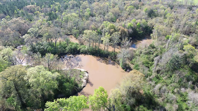
We decided to try our first section of the Tallahoma when heavy rains had swollen all of the nearby streams,a opening up the opportunity to paddle some shallow upstream tributaries that we otherwise thought would be impassable. We launched at the Indian Springs Rd. bridge which from appearances appeared to be frequented by local fishermen, swimmers and/or paddlers. The launch is best approached from Boots Smith Rd. which winds close to the launch under the bridge.
The entirety of this section of the Tallahoma was extremely crooked with numerous tight, horshoe bends. There were surprisingly few blockages, but numerous log jams that required substantial maneuvering. The water was high and swift after recent heavy rains, but it appeared that this lower section of the Tallahoma would be passable, even in normal water levels. Although, the creek passes through fairly populous small townd, it retained a rural and even wilderness feel. We encountered abundant wildlife, including a variety of duck species, great blue herons, kingfishers, hawks and a large owl. We even encountered an adult rabbit out on a tree that had fallen into and traversed about 1/3 of the river's width. When we approached to "rescue" it, it livened up, swam swiftly to the creek bank and scurried off.
The Tallahoma's confluence with Tallahala Creek was interesting with a very narrow bluff separating the two streams for several hundred feet. Because of the sketchyness of other potential take outs, we paddled forth along the Tallahala for a mile or so to our selected take out at the boat ramp on Hwy. 29 near Ellisville.