

The Bouie Creek has its origins near Magee and Mt. Olive in Simpson County, MS. At normal levels it generally becomes navigable by canoe and kayak where it crosses Hwy 589, North of Sumrall, MS in Covington County. The creek is joined by the Okatoma River just south of the Hwy. 49 bridge in North Hattiesburg and becomes the Bouie River. The river gently meanders through rural forests and farm country until it empties into the Leaf River at the Hwy 11 bypass near Chain Park in Hattiesburg. It forms several beautiful fishing lakes along the way and is dotted with sandbars and islands and some gentle rapids.
Two sections of the Bouie have now been designated as Pinebelt Blueways with landing signage and mile markers. The Upper Bouie Blueway starts at the public boat ramp at Hwy. 49 just north of Hattiesburg and ends where it crosses Peps Point Road. There is signage both at Hwy. 49 and Pep's Point Road. The Lower Bouie Blueway takes you from Pep's Point Road to Glendale Ave. This section has some nice little rapids passing a gravel island that is great fun to stop and play in. This section also opens up into two large lakes just before you reach the Glendale landing.
Click Below for NOAA Bouie River Water Level at Hattiesburg, MS. "Normal" range for recreational paddling on Black Creek are about 2.2 - 3.2 feet at Hattiesburg - Glendale.
SIX LANDINGS - FIVE TRIPS
SEMINARY-SUMRALL ROAD TO HWY. 589
BOUIE CREEK
SEMINARY-SUMRALL RD TO HWY 589
COVINGTON COUNTY
Launch – Seminary-Sumrall Rd (Dirt road to sandbar)
Take Out - Hwy 589 (Dirt road to sandbar)
Paddle Distance - 5.4 miles
Time - 3 - 3.5 hours (depending on water level and stops along the way)
Points of Interest (in order) -
Clear Run Creek - @ mile 2.34 - On Right
Hayden Creek - @ mile 4.87 - On Right
Driving Distance from Hattiesburg Train Station to Seminary-Sumrall Landing - 28 miles (35 minutes)
Driving Distance from Seminary-Sumrall Landing to Hwy. 589 Landing - 4.5 miles (6 minutes)
Driving Distance from Hwy. 589 Landing to Hattiesburg Train Station - 20 miles (31 minutes)

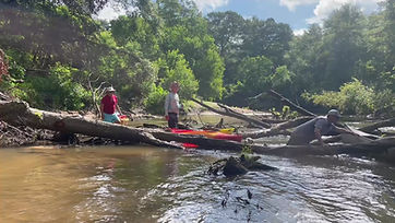
This section of Bouie Creek is the farthest upstream we have attempted to paddle. For years, we thought it was too narrow and shallow to paddle, except perhaps during very high water events. We were proved wrong by our good friends, Shawn and Amanda Harris, who paddled it in July of 2025 and raved about how beautiful it was. And they had pictures to prove it. We were given an opportunity to paddle it 0nly a couple of weeks later, and it is now in our top 10 of Mississippi paddling experiences. Now, to be sure, there were quite a few fallen trees we had to dodge along the way. But all of them were passable, except for one at the very beginning of the run that we had to drag over. Although, the water was very low this time of summer, we had very little trouble dodging the snags. In fact, the low water enabled us to pass under several of the fallen trees that may have been impassable in higher water.
Since this was such a short distance between the launch and the take out points, we decided to ride our e-bikes between landings. It was a beautiful day for it and added to the adventure.
The fact that the weather was dry, and we were farther upstream ensured that the creek water was extremely clear and remarkably cool for late summer.
The first part of the paddle was characterized by very narrow waterflow and a beautiful, shady canopy. The banks of the creek were covered in beautiful green moss and plenty of green undergrowth. The water was swift, and we floated without much need to paddle, except to dodge the frequent obstacles.
After the creek is joined by Clear Run Creek, it widens out, becomes slower and much less shadyt, taking on the characteristics of the lower Bouie Creek and River that are more typical of our South Mississippi experiences.
If you paddle slowly and quietly, you can expect to see Great Blue Herons, lesser Herons, and other birds and wildlife common to our rivers. There are a variety of wild flowers, and turtles and fish can be more easily seen in the clear waters.
We do warn you about the landings. They are primitive with unmaintained gravel/dirt drives with numerous large mudholes when there has been recent rain. A little encouragement


Hwy. 589 to Hwy 49
BOUIE CREEK
HWY. 589, PURVIS, MS TO HWY. 49, HATTIESBURG, MS
Launch – Hwy. 589 (Dirt drive to primitive sandbar)
Take Out - Hwy. 49 (Gravel drive to concrete boat ramp)
Distance - 11.5 miles
Time - 4-6 hours
Points of Interest (in order) -
Beaver Creek - @ mile 1.75 On Left
Tick Creek - @ mile 1.8 On Right
Unnamed Stream - @ mile 7.28 On Left
McCall Creek - @ mile 9 On Right
Drive from Hattiesburg Train Station to Hwy. 589 Launch - 19 miles (30 minutes)
Drive from Hwy. 589 Launch to Hwy. 49 Landing - 11 miles (13 minutes)
Drive from Hwy. 49 Landing to Hattiesburg Train Station - 11 miles (18 minutes)
This section of Bouie Creek is accessed by a primitive landing on a sandbar under the Hwy. 589 bridge north of Sumrall, MS that is accessible by a short dirt road/drive. It is approximately 11.5 river miles long. So far, we have paddled it twice and would do it again. We got crazy one night and wanted to hit the river so bad we made this trip in the middle of the night. Unfortunately, our lighting wasn't the best, so it was a real challenge dodging snags that would appear before us with only a short time to make adjustments.
In the daytime, we have encountered Great Blue Herons, Great White Herons, Kingfishers, hawks, mallard ducks and deer swimming the river on this section of the Bouie.
Hwy. 49 to Pep's Point Road
(Upper Bouie Blueway)
BOUIE RIVER
HWY. 49, HATTIESBURG, MS TO PEP’S POINT RD., HATTIESBURG, MS
UPPER BOUIE BLUEWAY
Launch – Hwy. 49 (Gravel drive to concrete boat ramp)
Take Out - Pep’s Point Rd. (Gravel drive to concrete boat ramp
.Distance - 6.65 miles
Time - 2.5 hours
Points of Interest (in order) -
Okatoma River - @ mile 1 On Left
Providence Creek - @ mile 4.8 On Left
Railroad Bridge - @ mile 5.7
Drive from Hattiesburg Train Station to Hwy. 49 Launch - 11 miles (18 minutes)
Drive from Hwy. 49 Launch to Pep’s Point Rd. Landing - 4.2 miles (5 minutes)
Drive from Pep’s Point Rd. Landing to Hattiesburg Train Station - 8.4 miles (17 minutes)
From the public boat ramp on Hwy. 49 just north of Hattiesburg, it is only a short float to the mouth of the Okatoma River. Past the Okatoma, Bouie Creek becomes the Bouie River and meanders downstream to a nice takeout at the public boat ramp at Pep's Point Road. This section of the Bouie is beautiful with numerous steep bluffs and plenty of sandbars to stop and swim or picnic at. Wildlife is abundant with egrets, herons, king fishers and lots of signs of small and large mammals.
The entire trip is only about 6.65 miles from put in to take out. We have paddled this section many times. The last float took us about 2.5 hours with the river at what I would consider its normal level of 2.2 ft. at the gauge at Glendale. This section is also blessed with easy access with the put in on major Hwy. 49 and the take out just one turn off of Hwy. 49. Both landings have concrete boat ramps in good condition with Blue Way signage.


Pep's Point Road to Glendale Avenue
(Lower Bouie Blueway)
PEP'S POINT ROAD TO GLENDALE AVENUE
(LOWER BOUIE BLUEWAY)
BOUIE RIVER
PEP’S POINT RD., HATTIESBURG, MS TO GLENDALE AVE, HATTIESBURG, MS
LOWER BOUIE BLUEWAY
Launch – Pep’s Point Rd. (Gravel drive to concrete boat ramp)
Take Out - Glendale Ave. (Gravel Drive to concrete boat ramp)
Distance - 7.75 miles
Time - 3-4 hours
Points of Interest (in order) -
Mineral Creek - @ mile 3.1 On Right
Unnamed Stream - @ mile 3.36 On Right
Hwy. 59 Bridge - @ mile 4.6
Mixon’s Creek - @ mile 5.56 On Right
First Gravel Pit Lake - @ mile 6
Second Gravel Pit Lake - @ mile 7.3
Green’s Creek - @ mile 7.88 (On Right)
Drive from Hattiesburg Train Station to Pep’s Point Rd. Launch - 8.3 miles (15 minutes)
Drive from Pep’s Point Rd. Launch to Glendale Ave. Landing - 6.3 miles (10 minutes)
Drive from Glendale Ave.. Landing to Hattiesburg Train Station - 2.3 miles (7 minutes)
This is an exciting section of the Bouie River that that runs about 7.75 miles and takes about 3-4 hours, depending on stops along the way. In 2021, it was designated the Lower Bouie Blue Way with signage at the launch and take out with mile markers along the way.
It includes a small set of rapids branching off of a gravel island that offer a fun play stop for kids and adults alike to float over and swim in.
There is also a nice log dwelling that operates as a Bed & Breakfast at the point of the rapids called River Ranch Bed and Breakfast.
The Pep's Point Rd. launch is scheduled for significant improvements in the near future, including adding a fish cleaning station.
This section of the Bouie also ends with two good sized lakes with sand bars and islands that make for great camping spots and swim holes. Fish are abundant in these lakes. The take out is a public boat ramp at the Glendale Ave. bridge.


_edited.jpg)
Glendale Ave. to Hwy. 11 Bypass/Chain Park
BOUIE RIVER
GLENDALE AVE, HATTIESBURG, MS TO HWY. 11 BYPASS/CHAIN PARK, HATTIESBURG, MS
Launch – Glendale Ave. (Gravel Drive to concrete boat ramp)
Take Out - Hwy. 11 Bypass/Chain Park (Paved road to gravel parking & concrete boat ramp)
Distance - 2 miles
Time - 3-4 hours
Points of Interest (in order): Gravel Pit Lakes
Drive from Hattiesburg Train Station to Pep’s Glendale Ave. Launch - 2.3 miles (8 minutes)
Drive from Glendale Ave. Launch to Hwy. 11 Bypass/Chain Park Landing - 2.2 miles (5 minutes)
Drive from Hwy. 11 Bypass/Chain Park Landing to Hattiesburg Train Station - 2.5 miles (7 minutes)
From the public boat ramp at Glendale Avenue to the public boat ramp at the Hwy. 11 Bypass at Chain Park in Hattiesburg where the Bouie empties into the Leaf River, this section of the of the Bouie consists mostly of a large lake and a short stretch of river winding to the Leaf. We do not recommend putting in at the concrete boat ramp, because it will take you over a small, rubble dam that is notorious for wrecking boats and a dangerous undertow. Boaters and swimmers have lost their lives here over the years. The best put in is a short walk down to a sandbar just downstream from the dam where the water is gentle.
There are a few nice sandbars along the way to stop and swim at, and the small peninsula between the Leaf and Bouie is quite beautiful and interesting to stop and play at. We highly recommend this trip for a pleasant, short getaway close to Downtown Hattiesburg.